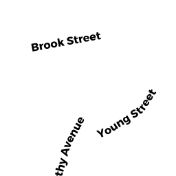
22 HOWARD TR
Owner Information
GUNTOR CINDY L
22 HOWARD TR
CHERRY VALLEY, MA 01611


Property Details
22 HOWARD TR is classified as a Single Family Residential (Old style).
The primary structure on this property was built in 1891. There are 1,313ft2 of built area within this property. There is 1,313ft2 of residential/living space within this property. This property is listed as having 7 rooms.
22 HOWARD TR is valued at $265,300. The land is valued at $55,200 and the structures are valued at $194,800. There is an additional valuation of $15,300 on this property.
This property is in Zone R2. Confirm with local Zoning Board authorities to ensure there are no overlays or other easements on this property.
The most recent deed for 22 HOWARD TR is recorded at the local registrar in Book 59171, Page 57. 22 HOWARD TR was last sold on Friday, July 27, 2018 for $230,000.
Assessment data from fiscal year 2022.
Flood Data
This property is partially within the A Zone (within floodplain). Approximately 0.0 acres (0.06%) of the property is within this zone.
This information is sourced from the FEMA National Flood Hazard Layer. See our full disclamer.
Broadband Internet Providers
| Provider | Type | Bandwidth (mbps) | |
|---|---|---|---|
| Verizon New England Inc. | DSL | 5 | 0 |
| Viasat Inc | Satellite | 100 | 3 |
| GCI Communication Corp. | Satellite | 0 | 0 |
| Crown Castle Fiber | Fiber | 0 | 0 |
| HughesNet | Satellite | 25 | 3 |
| VSAT Systems, LLC. | Satellite | 2 | 1 |
| T-Mobile | Fixed Wireless | 25 | 3 |
| Charter Communications Inc | Cable | 940 | 35 |
Broadband service provider data from December 2020.